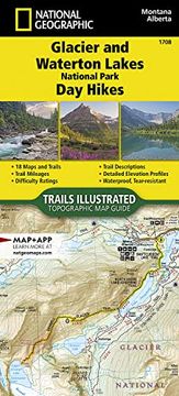
Glacier and Waterton Lakes National Parks day Hikes map (National Geographic Topographic map Guide, 1708) (in English)
Synopsis "Glacier and Waterton Lakes National Parks day Hikes map (National Geographic Topographic map Guide, 1708) (in English)"
- Waterproof - Tear-Resistant - Topographic MapTogether, Glacier National Park in the United States and Waterton Lakes National Park in Canada hold the honor of being the world's first international peace park. Divided by a 19 mile (30.5 km) international boundary, they are further designated by UNESCO as both a biosphere reserve and a World Heritage site, and they are recognized as Dark Sky Parks due to their remoteness. The broader landscape around the parks--known as the Crown of the Continent ecosystem--is a laboratory for collaborative, transboundary conservation that spans from high-peaked mountains to prairie, teeming with diverse plants and animals, making it a spectacular setting for hiking and outdoor recreation. The 18 diverse day hikes featured in Glacier and Waterton Lakes National Parks Day Hikes Topographic Map Guide booklet are organized into sections--dividing the parks into six regions for day hikes: North Fork, Lake McDonald, Two Medicine, Saint Mary, Logan Pass, Many Glacier, and Waterton Lakes, Goat Haunt sections. Day hikes visit historical and natural sites like the century-old Sperry Chalet, the Continental Divide, scenic waterfalls, many glaciers, and glacially carved lakes and mountain valleys. The hikes range in difficulty and distance to help hikers select the best trail for their timing, abilities, and location within the parks. Each hike includes a trail description, directions to trailhead, elevation profile, total elevation gain, and trail mileages. Trail statistics are given in both imperial and metric units.More convenient and easier to use than folded maps, but just as compact and lightweight, National Geographic's Topographic Map Guide booklets are printed on "Backcountry Tough" waterproof, tear-resistant paper with stainless steel staples. A full UTM grid is printed on the map to aid with GPS navigation.Map Scale = 1:31,680Folded Size = 4.25" x 9.38"

