Share
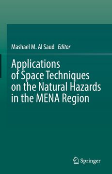
Applications of Space Techniques on the Natural Hazards in the Mena Region (in English)
Al Saud, Mashael M. (Author)
·
Springer
· Hardcover
Applications of Space Techniques on the Natural Hazards in the Mena Region (in English) - Al Saud, Mashael M.
$ 132.62
$ 139.99
You save: $ 7.37
Choose the list to add your product or create one New List
✓ Product added successfully to the Wishlist.
Go to My WishlistsIt will be shipped from our warehouse between
Wednesday, July 03 and
Thursday, July 04.
You will receive it anywhere in United States between 1 and 3 business days after shipment.
Synopsis "Applications of Space Techniques on the Natural Hazards in the Mena Region (in English)"
This book introduces a comprehensive understanding in the use of space techniques in natural hazards and risk management in the MENA Region. The book is based on different case-studies from 25 MENA countries, and will be useful in highlighting the issues from all aspects. In recent years the number of natural hazard events has increased in the MENA Region. This is exacerbated by the changing climate and extreme climate events, as well as a large increase in the population in this area. Disastrous events occur on a yearly basis characterized by a vulnerability of physical processes. Floods, earthquakes, and mass movement result in severe damage to property and livelihoods, and have devastating effects upon the environment. These events cause severe financial losses, which on an annual basis, can exceed millions of dollars. The predication, assessment and monitoring approaches remain inadequate in managing these hazards and in mitigating their impacts, but with the development of space techniques and geo-information systems, these situations can now be better managed. The miscellany of satellite images, with different spatial and temporal resolutions, enable the detection of terrain features and provide indications of potential natural risks. This book will of interest to stakeholders, including field experts, academics, researchers and decision makers.
- 0% (0)
- 0% (0)
- 0% (0)
- 0% (0)
- 0% (0)
All books in our catalog are Original.
The book is written in English.
The binding of this edition is Hardcover.
✓ Producto agregado correctamente al carro, Ir a Pagar.

